
We’re pleased to announce a new project for the Golden Gate National Parks Conservancy. We’ve redesigned and built a new map, and trail visualizations to help people get to the parks in the Bay Area.
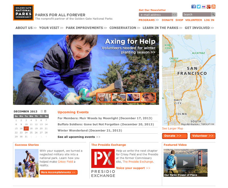
Since 1981 — in partnership with the National Park Service and Presidio Trust — this local non-profit has provided over $250 million in support to the Golden Gate National Parks, rallied more than 250,000 volunteers, pioneering innovative park stewardship and education programs, like this art installation on Alcatraz featuring Ai Wei Wei.
Earlier this spring, the Parks Conservancy reached out to us to help with a new initiative: creating a beautiful map to help more locals (and tourists) get outside and into the Golden Gate National Recreation Area, the nation’s largest urban national park, and to make it easier for Conservancy staff to create new maps and events on the website.
Part of our remit was also to build on existing efforts within the Conservancy wherever we could. For example, the Conservancy already works with Transit and Trails, which connects people with the trails in the Bay Area and beyond. We use their trail database to power anew curated trails page. Their data folds into the new map, along with an events calendar, locations and links for partner programswithin the parks, and more.
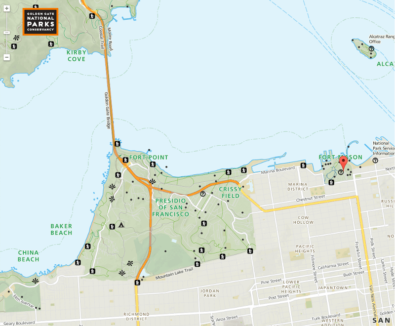
We redesigned the “Big Map” from the ground up, using data from across the web. Sources include the Parks Conservancy, Presidio Trust, San Francisco State University, California Protected Areas Database, Transit & Trails, OpenStreetMap, the United States Geological Survey, and the National Parks Service. Phew!
Here’s what it looks like:
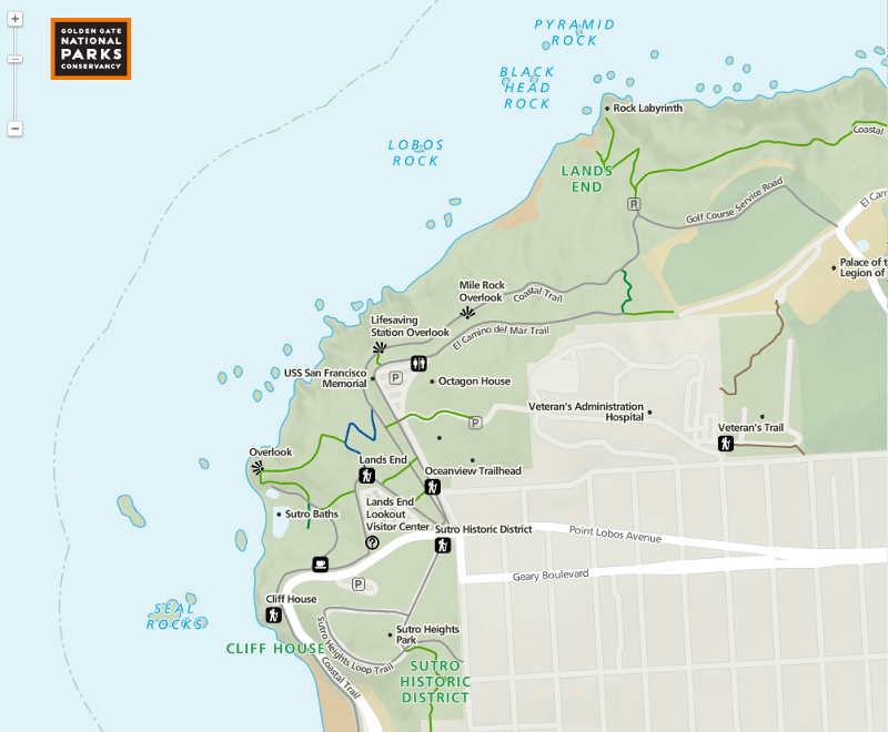
We had fun one day making sure all the overlooks pointed in the direction of their respective views:
We’ve also deployed our handy “make the URL as dynamic as possible” to enable all sorts of new deep-linking, like, straight to thistrailhead at Dias Ridge:
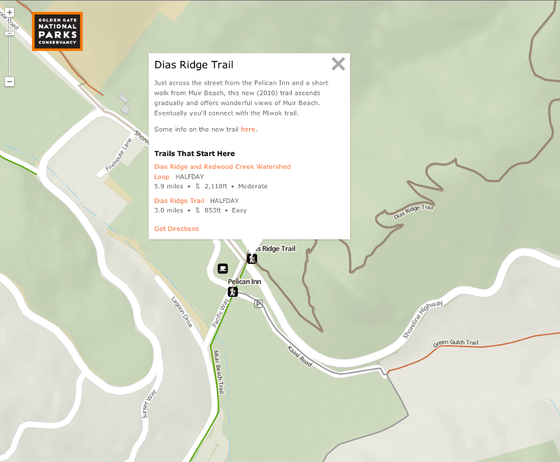
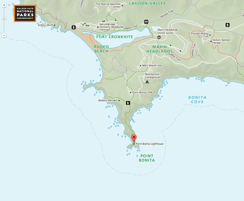
There are also “Little Maps” sprinkled across the site. In addition to making them gorgeous, we worked with Parks Conservancy staff to streamline their ability to make new ones for new events or other content.
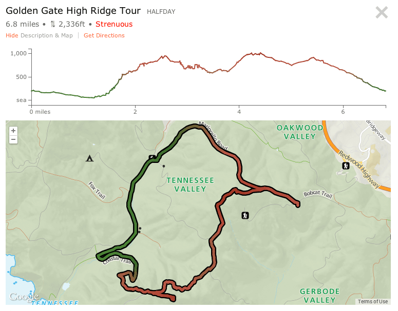
There’s a new Trails page too, designed to help you see what a hike is like before you’re up the mountain. We’ve launched with a starting list of some 20 trails, and we’ve built a streamlined data pipe from the Transit and Trails system straight into parksconservancy.org. (The end game here is loads and loads of trails and trips created by friends of the Parks.) We like how you can move your mouse over either the elevation profile (above) or the trail on the map to see where you are.
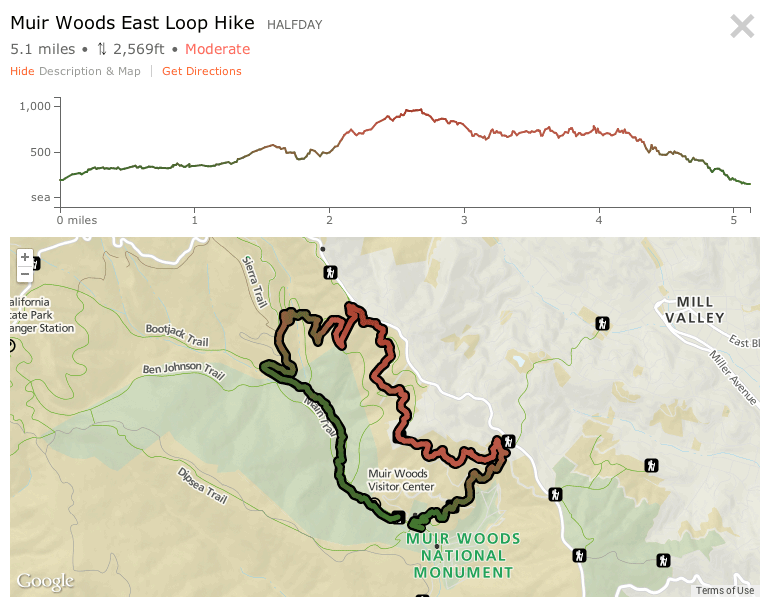
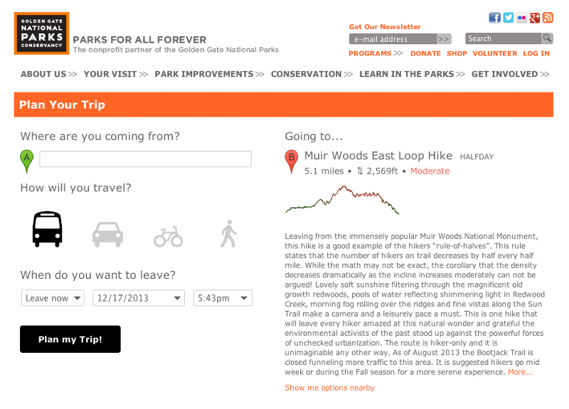
Say you wanted to go and do this hike, you can feed it into the new Trip Planner we’ve built too. Wherever you see a “Get Directions” link, hitting it will feed you straight into the trip planner. By the power of teh Googles, we can grab directions for you in a jiffy.
Throughout the project, we’ve been genuinely delighted with the amount of interest and effort of various groups around the Bay to protect and enhance our open spaces. Workshops and conversations with folks from the Parks Conservancy, the National Parks Service, and theBay Area Open Space Council (many of which include volunteers as well as senior and junior staff) have given us tremendous insight into the work of this network of talented, passionate people. These people work tirelessly to protect and preserve natural open spaces in California, and it’s a pleasure to be able to provide work that will help them in this mission.
Our hope is that the work doesn’t stop here, and we don’t think that it will. For one, we’re crossing our t’s and dotting our i’s on a few new open source tools that we created during the project, which we’ll post about once we’ve gotten the their READMEs in good shape.
Future potential definitely calls for much more input, stories, and content from Conservancy staff and volunteers. Our favorite part of this job (aside from designing the lovely new cartography) was learning about how so many different people feel about and use open spaces near them. Some of our other projects this year have circled the Great Outdoors theme too, and it’s fun to think about how the work and thinking could dovetail later on. (More about that later!)