
For the past few months, we’ve been quietly working under a grant from the Knight Foundation to do something that no one seems to have done before: publicly compiling as many open-licensed, locally-created terrain data sets as possible to stitch together a global set.
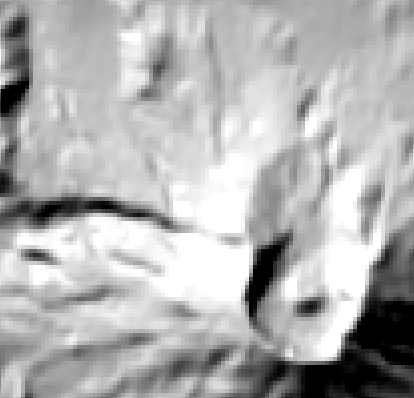
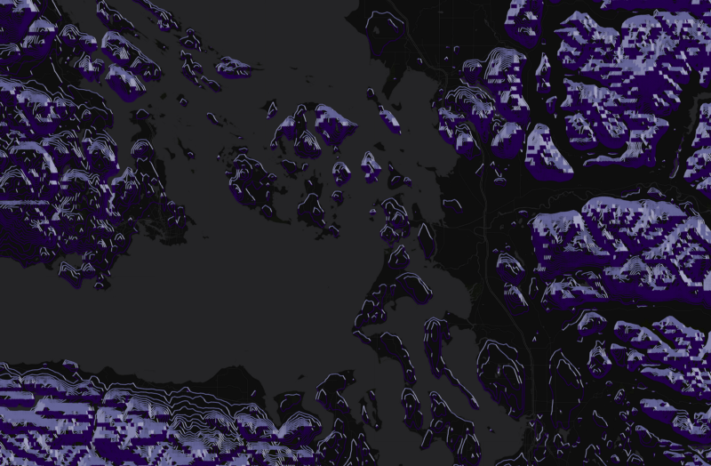
Esri, Mapbox, NASA,Google, Mapquest and others already make terrain maps available. The challenge our project is intended to address, in addition to bringing a different set of design values to the maps themselves, is access to what’s under the hood. Access to the underlying data is often proprietary (like Esri’s terrain data) or otherwise restricted. This means that if someone wants to experiment with this data, they’re pretty much SOL. Low-resolution data exists for the whole world, thanks to NASA and their freely available SRTM 90mdataset, and the ongoing release of 30m data. The challenge is that once you start zooming in, even at 30m resolution, the visual impact of the data starts to break down:
The free and open medium- to high-resolution data that we can find is often limited to a single country or region, and it’s scattered all over the place. We want to use this project to change that by creating a public repository containing lists of these open datasets, a merged “best available open data” view, and creating instructions and processes to stitch these datasets together.
To make things more complicated, most raw digital elevation data requires some amount of cleanup to fill in holes in the data or otherwise remove artifacts. Everybody who uses the same open data sources has to fix the same errors, resulting in a lot of unnecessarily duplicated effort. Our workflow will include these cleanup steps (which typically involve using data sourced elsewhere), providing a seamless and ready-to-use service sourced from various datasets all over the world.
Yesterday we put out a call for these datasets on Twitter, and have been amazed and delighted by the response. In less than 24 hours, we’ve been given leads to data sets that we were unaware of from Norway (thx @andershartmann), Australia (thx @AllanBarger), Germany (thx @cartocalypse), and more. We’ve also gotten pointers to bathymetry data, too! We’ll take it!
This is a great start, but we need your help to make this the best data collection it can be.
Here’s how you can help:
1. Send us open terrain data sets. There’s a few different ways to get this to us:
- Twitter // @stamen
- Email // openterrain@stamen.com
- Post directly to the wiki // github.com/openterrain/openterrain/wiki/Terrain-Data
If you know the license and the resolution of the data, please include that too. Licensing is important, and is one of the major hurdles encountered when we work with terrain data. Keeping track of all data sources regardless of license is incredibly helpful, although we intend to stick to non-ambiguously licensed open data when producing the worldwide map.
2. Follow what we’re doing at openterrain.tumblr.com. It’s our hub for public project updates, which are sometimes super nerdy and often really pretty.
3. Spread the word! You might not know where to find this data, but you might know someone who does. Send them this post, or even just retweet this Tweet.
Once we have this data, we’ll update our in-house terrain style and create terrain-enhanced versions of the Positron and Dark Matter basemaps we designed for CartoDB. These basemaps are free for anyone to use in their own mapping projects!
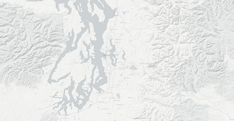
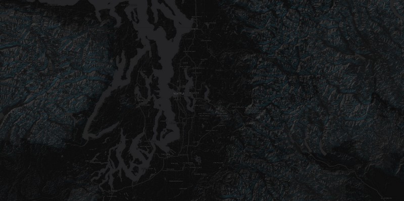
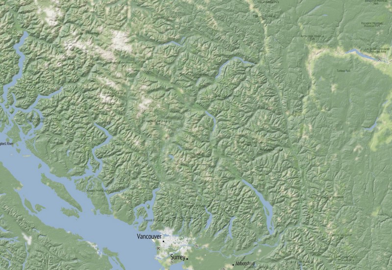
Plus, we can make more beautiful experiments like these, for everywhere in the world:
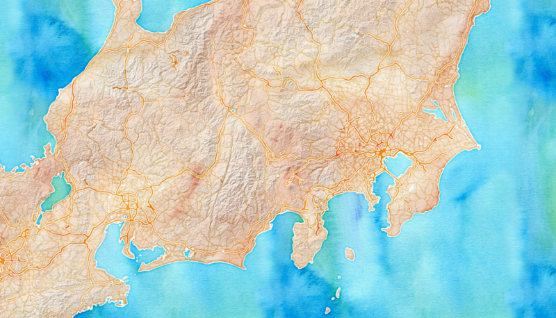
What’s even better, is that you’ll be able to, too.