

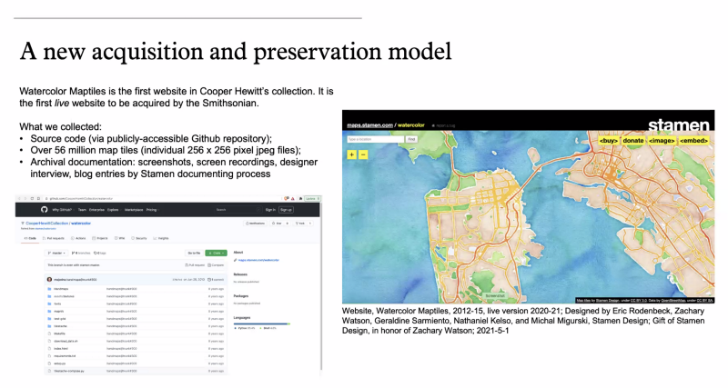
Today the Cooper Hewitt (the Smithsonian Design Museum) officially added Stamen’s OpenStreetMap-based Watercolor map to its collection, the first live website to ever become part of the Smithsonian.
Learn more from the Cooper Hewitt press release and the announcement event recorded on YouTube:
We are especially grateful to the hundreds of thousands of volunteer contributors to the OpenStreetMap project who created the data that made this map possible. The Watercolor map is a gift in memory of the late Zach Watson, who was one of the core developers who created the Watercolor map. We’d also like to specifically congratulate Stamen alumni Geraldine Sarmiento, Nathaniel Kelso, and Michal Migurski who all played a major role in creating the map.
We will be sharing more information about the acquisition in the near future, but for now we just wanted to share our gratitude and our excitement that this unique cartographic artifact will be preserved forever by the Smithsonian for the enjoyment and inspiration of everyone. ❤️